 |
The Grounding of the s.s. Argus, July 1895. |
|
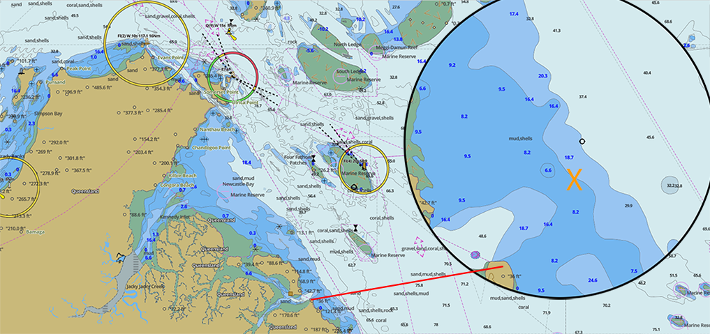
| I have not been able to find any reference to "X Reef" on any maps or nautical charts. From the information gleaned from newspapers of the day, they say the grounding was 14 NM south of Somerset and 1 NM West (inshore) of track. Based on that information, the orange X marks the approximate position of the grounding. Note: Soundings on this map are in feet. |
| ALL RIGHTS RESERVED - All material used on this site is copyright - No photographs or other material may be used without the express written permission of the web master - 2014 |